| View previous topic :: View next topic |
| Author |
Message |
Snowygrouch
Validated Poster


Joined: 02 Apr 2006
Posts: 628
Location: Oxford
|
 Posted: Thu Aug 17, 2006 10:38 am Post subject: GOT THE OFFICIAL FLIGHTPATHS!!!!!!! Posted: Thu Aug 17, 2006 10:38 am Post subject: GOT THE OFFICIAL FLIGHTPATHS!!!!!!! |
 |
|
All,
HORAYYY!!!
After waiting for ages I recieved 3 CDROMs from the National Transportation Saftey Board this morning.
After feeling rather gazumped by the prior release of the studies I think I`ve got some new stuff here although there is so much on the CDs it may take me some time to go through it all.
However there are MPEG animations of the planes flightpaths!
Does anyone else have this already?
Anyway I`m so excited im almost gibbering with pleasure 
Got to go and delve!
Cheerio
Calum
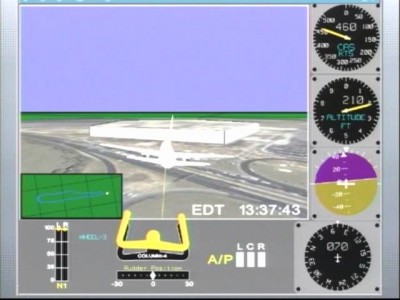
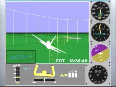
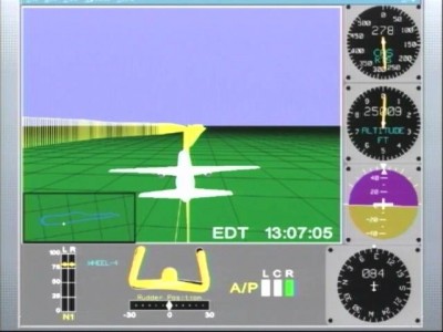
The screenshot is the flight due to hit the pentagon so I`ll be observing that impossible manuever shortly!
| Description: |
|
| Filesize: |
37.2 KB |
| Viewed: |
79 Time(s) |

|
| Description: |
|
| Filesize: |
36.71 KB |
| Viewed: |
45 Time(s) |

|
| Description: |
|
| Filesize: |
36.2 KB |
| Viewed: |
43 Time(s) |

|
_________________
The potential for the disastrous rise of misplaced power exists, and will persist
President Eisenhower 1961 |
|
| Back to top |
|
 |
Snowygrouch
Validated Poster


Joined: 02 Apr 2006
Posts: 628
Location: Oxford
|
 Posted: Thu Aug 17, 2006 10:55 am Post subject: First Oddity already! Posted: Thu Aug 17, 2006 10:55 am Post subject: First Oddity already! |
 |
|
All,
The first thing I`ve noticed ALREAY is that when the plane is over the motorway before it hit the Altimeter is reading 180 feet!
How exactly did it knock over the light poles if it was nearly 200 feet up?
It also contradicts the Pentagon CCTV which clearly shows the object travelling horizontally as it approaches not diving in from 200 feet up.
I think this is very strong evidence that either the NTSB or the Pentagon VIDEO is faked or manipulated.
Calum
_________________
The potential for the disastrous rise of misplaced power exists, and will persist
President Eisenhower 1961 |
|
| Back to top |
|
 |
Andrew Johnson
Mighty Poster


Joined: 25 Jul 2005
Posts: 1919
Location: Derbyshire
|
 Posted: Thu Aug 17, 2006 11:56 am Post subject: Posted: Thu Aug 17, 2006 11:56 am Post subject: |
 |
|
Good work!
Haven't you heard of those new expanding and contracting lampposts?
_________________
Andrew
Ask the Tough Questions, Folks! |
|
| Back to top |
|
 |
TRUTH
Moderate Poster

Joined: 15 Feb 2006
Posts: 376
|
|
| Back to top |
|
 |
Snowygrouch
Validated Poster


Joined: 02 Apr 2006
Posts: 628
Location: Oxford
|
 Posted: Thu Aug 17, 2006 2:29 pm Post subject: NSArchives Posted: Thu Aug 17, 2006 2:29 pm Post subject: NSArchives |
 |
|
Truth,
Thanks but I had downloaded all that when some other kind sould posted it here a few days back.
I think this MPEG video is fairly unique though, well obviously someone else in the world MUST have it but so far I havent spotted it anywhere else.
I still havn`t had time to go through it all yet to be honest!
I suspect there are some gold nuggest in there.
Typically enough there is still very little data for Flight 93.
The other point I`ll have to acertain is if the flight 77 data I have is from Radar or Black Box. If its from radar thats VERY odd as officially flight 77 disappered from radar for some time.
Anyway
Cheerio
Calum
_________________
The potential for the disastrous rise of misplaced power exists, and will persist
President Eisenhower 1961 |
|
| Back to top |
|
 |
chipmunk stew
Moderate Poster


Joined: 19 Jul 2006
Posts: 833
|
 Posted: Thu Aug 17, 2006 2:39 pm Post subject: Re: First Oddity already! Posted: Thu Aug 17, 2006 2:39 pm Post subject: Re: First Oddity already! |
 |
|
| Snowygrouch wrote: | | The first thing I`ve noticed ALREAY is that when the plane is over the motorway before it hit the Altimeter is reading 180 feet! |
Just a note, not here to debate: altimeters measure altitude above sea level.
Back to the Kritiks' Korner I go...
Carry on!
|
|
| Back to top |
|
 |
Snowygrouch
Validated Poster


Joined: 02 Apr 2006
Posts: 628
Location: Oxford
|
 Posted: Thu Aug 17, 2006 2:59 pm Post subject: Chipmunk Posted: Thu Aug 17, 2006 2:59 pm Post subject: Chipmunk |
 |
|
Hello,
Yes I`m perfectly aware that altimeters use atomspheric pressure and so are above sea level.
However when you look at the MPEG video (as you can see from one frame I screen grabbed) the plane is obviously VISUALLY well above the roof of the pentagon itself when over the light poles.
Can I explain that?
NO
I have no idea if the flight data or the poles are incorrect but they cannot BOTH be correct.
And thats rather the point!
The frame I posted above is a few before the last one where it is really obvious. (as you can see the frame there is 210 feet up).
If you like I can post the final frame later on.
Calum
_________________
The potential for the disastrous rise of misplaced power exists, and will persist
President Eisenhower 1961 |
|
| Back to top |
|
 |
The Watcher
Validated Poster

Joined: 09 Aug 2006
Posts: 200
|
 Posted: Thu Aug 17, 2006 3:11 pm Post subject: Flight Path - Flight 77 Posted: Thu Aug 17, 2006 3:11 pm Post subject: Flight Path - Flight 77 |
 |
|
Chipmunk Spew (out of his box) wrote:
| Quote: | | Just a note, not here to debate: altimeters measure altitude above sea level. |
The highest point in the District of Columbia is 410 feet (125 m) above sea level at Tenleytown. The lowest point is sea level, which occurs along all of the Anacostia shore and all of the Potomac shore except the uppermost portion (the Little Falls - Chain Bridge area) - Source: Wikipedia
The Pentagon sits about 250m west and roughly level with the shore of the lagoon, which is linked directly to the Potomac River; i.e. sea level!
The following is an extract from: www.911-strike.com/quantum-path.htm
| Quote: | Starting over the Sheraton and ending at the Pentagon, and noting that Lagasse estimated that the 757 passed 50 feet over the Annex, and 80 feet over the gas station, and estimating that the 1st lamp post was at least 40 feet tall, we obtain the following estimates for the aircraft altitude over sea level at various checkpoints:
0 mile mark (Sheraton) -- 320 feet
0.35 miles (Naval Annex) -- 230 feet
0.6 miles (gas station) -- 125 feet
0.75 miles (1st lamp post) -- 70 feet
0.95 miles (Pentagon hit) -- 50 feet
These estimates are consistent with an average descent rate of about 1 foot vertically for each 20 feet horizontally, except for a (possibly problematic) dip at the first lamp post, and subsequent leveling-out. At any rate it is difficult to justify the idea that the plane was low enough over Highway 27, to have clipped the antenna of a Jeep Cherokee, as Frank Probst claimed.
In fact, the real difficulty may be how the airplane managed to maintain this continuous downward flight path. If the pilot was trying hard to push the airplane down as close to the ground as possible, the craft would have encountered "ground effect", an increase of lift and decrease of drag experienced by low-wing aircraft operating a few feet above the terrain. This effect can make it very difficult to land an airplane until all excess speed has been "bled off". |
Now Chippy, your point being? Rhetorical question.
The Watcher
|
|
| Back to top |
|
 |
blackcat
Validated Poster


Joined: 07 May 2006
Posts: 2376
|
 Posted: Thu Aug 17, 2006 3:23 pm Post subject: Posted: Thu Aug 17, 2006 3:23 pm Post subject: |
 |
|
| Don't waste your time with him. His next move is to say those altimeters are only accurate to within a hundred feet or some such invention to suit his agenda. The fact these people even dwell here says all you need to know about them. They are attempting to discredit the call for an enquiry which might - just might - bring some truth to light and they clearly do not want this to happen. Anyone who believes the 9/11 inquiry answers the events of that day and explains everything is a traitor or an idiot or both. An enquiry is urgently needed to get to the truth and they fear this. I can only speculate as to why.
|
|
| Back to top |
|
 |
Snowygrouch
Validated Poster


Joined: 02 Apr 2006
Posts: 628
Location: Oxford
|
 Posted: Thu Aug 17, 2006 3:28 pm Post subject: Altitude correction Posted: Thu Aug 17, 2006 3:28 pm Post subject: Altitude correction |
 |
|
All,
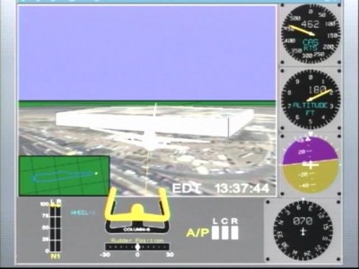
Here is the final frame from the video showing the plane vertically over the position of the poles AND above the roof line of the Pentagon.
The Altitude is 180 feet ASL (above sea level) or about 130 feet above ground if you want to be exact as pointed out by Chip.
I 'aint here to explain it chaps but it looks fricking ODD to me.
Calum
| Description: |
|
| Filesize: |
37.5 KB |
| Viewed: |
48 Time(s) |

|
_________________
The potential for the disastrous rise of misplaced power exists, and will persist
President Eisenhower 1961 |
|
| Back to top |
|
 |
blackcat
Validated Poster


Joined: 07 May 2006
Posts: 2376
|
 Posted: Thu Aug 17, 2006 3:57 pm Post subject: Posted: Thu Aug 17, 2006 3:57 pm Post subject: |
 |
|
A 757 is equipped with two kinds of altimeter. The conventional barometric (above sea level) altimeter as well as a Radar Altimeter.
"RADAR ALTIMETER. Unlike a normal altimeter, which shows altitude above SEA LEVEL, the Radar altimeter displays altitude above THE GROUND. "
http://webpages.charter.net/flyian/757-767/capt.htm
These are accurate to within a tiny fraction of a percent of altitude. Does the info you have show the reading of the Radar Altimeter?
|
|
| Back to top |
|
 |
Snowygrouch
Validated Poster


Joined: 02 Apr 2006
Posts: 628
Location: Oxford
|
 Posted: Thu Aug 17, 2006 4:09 pm Post subject: Radar or Pressure Altitude? Posted: Thu Aug 17, 2006 4:09 pm Post subject: Radar or Pressure Altitude? |
 |
|
Blackcat,
It is not stated in any of my documentation.
I will need to write to the NTSB to discover this.
May be several weeks before i have an answer on that.
Calum
_________________
The potential for the disastrous rise of misplaced power exists, and will persist
President Eisenhower 1961 |
|
| Back to top |
|
 |
freddie
Moderate Poster

Joined: 21 Feb 2006
Posts: 202
Location: London
|
 Posted: Thu Aug 17, 2006 4:18 pm Post subject: Posted: Thu Aug 17, 2006 4:18 pm Post subject: |
 |
|
Alright Calum,
This could be interesting, but until we know what these figures (and thus the whole simulation) are based on, it's meaningless.
The sources of measurements (speed, altitude, flight path etc) must be on the disk - is there a text file?
Peace
_________________
- www.takectrl.org - |
|
| Back to top |
|
 |
johndoex
Minor Poster

Joined: 17 Aug 2006
Posts: 87
|
 Posted: Thu Aug 17, 2006 4:46 pm Post subject: Posted: Thu Aug 17, 2006 4:46 pm Post subject: |
 |
|
Hi Snowy..
Thanks for posting that. We have the FDR data from the NTSB and are currently analyzing it over at the loose Change forums.
Is it possible you can upload those mpegs to a host for download?
visit loose change site here and register. Im an Admin there. We have set up a specific forum for the FDR. If you register at Loose Change.. i can give you access to that forum
Thanks again for posting this info..
http://s15.invisionfree.com/Loose_Change_Forum/index.php?showforum=19
PM me at Loose Change and let me know your ID. Also put your ID on this thread so i know its you...
|
|
| Back to top |
|
 |
Snowygrouch
Validated Poster


Joined: 02 Apr 2006
Posts: 628
Location: Oxford
|
 Posted: Thu Aug 17, 2006 4:50 pm Post subject: Measurements Posted: Thu Aug 17, 2006 4:50 pm Post subject: Measurements |
 |
|
hi Freddie,
I have some stuff on measurements but it will take me hours to go through properly, the data for the flight reports (that is just the text of times, communications etc) was collated from numerous sources of varying accuracy including Primary Radar, Secondary Radar, Black Box data etc all of which are included in making all/part/undisclosed peices of the report.
The thing is this simulation is not a student pissing around effort this is the official NTSB flight crash investigation flight recreation.
I would think if I were making this animation that if I didnt have hard data past a particular point I would NOT run the simulation that far. Hence that the plane stops about 100meters from the wall.
The other data to back up a DIVE from height rather than a dive then come in along the ground is the YOKE positioning which is also included in the DATA. The information goning on in the cockpit display there is fairly comprehensive and collaboratory (I think I just made that word up but I like it)
Seriously if you watch the last minuite of flight it does NOT look like that object buzzing in low on the CCTV frames.
Also why make a model of the Pentagon and paste a raster graphic of the roads on if you are not confident if its accuracy?
Well I dont know for sure now and as I said I`ll be contacting the NTSB again to get confirmation on the data sources.
Unitil then I suppose we wont know 100%. 
_________________
The potential for the disastrous rise of misplaced power exists, and will persist
President Eisenhower 1961 |
|
| Back to top |
|
 |
Russell Pickering
New Poster

Joined: 17 Aug 2006
Posts: 3
Location: Cody, Wyoming
|
 Posted: Thu Aug 17, 2006 4:58 pm Post subject: Posted: Thu Aug 17, 2006 4:58 pm Post subject: |
 |
|
Hello,
My name is Russell Pickering. I have the website http://www.pentagonresearch.com/
Congrats on the data.
In our Loose Change forum we are working on the FDR info that we recently received. You can PM me and I can arrange for you to contact the administrator of the private forum on that.
Is there a way for you to upload the data you have so it can be downloaded? Again, if you PM me maybe I can arrange for you to put it on my server if you don't have an option.
I am consulting on a documentary and going to DC next week for some investigation and seeing what you have would be very useful.
In case you are not aware of it, here are some other documents released recently: http://www.gwu.edu/~nsarchiv/NSAEBB/NSAEBB196/index.htm
Thank you!
_________________
Russell Pickering
http://www.pentagonresearch.com/ |
|
| Back to top |
|
 |
Russell Pickering
New Poster

Joined: 17 Aug 2006
Posts: 3
Location: Cody, Wyoming
|
 Posted: Thu Aug 17, 2006 5:39 pm Post subject: Posted: Thu Aug 17, 2006 5:39 pm Post subject: |
 |
|
I am PMing you back. Sorry I am suffering a little learning curve here with the new tools. lol
_________________
Russell Pickering
http://www.pentagonresearch.com/ |
|
| Back to top |
|
 |
Russell Pickering
New Poster

Joined: 17 Aug 2006
Posts: 3
Location: Cody, Wyoming
|
 Posted: Fri Aug 18, 2006 5:26 pm Post subject: Posted: Fri Aug 18, 2006 5:26 pm Post subject: |
 |
|
We are doing an analysis of the FDR data we received in the Loose Change forum. The actual data raw off the .cvs file puts the impact at 173 feet above mean sea level. The grass at the Pentagon is approximately 40 feet above MSL. This is confirmed by the survey information I found on the new Pentagon memorial.
The altimeter reading we have is from the pressure altimeter. In the .cvs file we also discovered it had been set appropriately to ambient conditions not too long before the impact.
I talked to an NTSB agent and a private FDR analysis company about this. They say the error of 133 feet is not uncommon in investigations. The thing that will confirm this is the radar altitude data in the FDR that was not extrapolated into the .cvs. We are currently raising money and working with a couple of private companies to get our own data file to see what the data fields they did not publish contain.
There will be more on this later.
Russell
_________________
Russell Pickering
http://www.pentagonresearch.com/ |
|
| Back to top |
|
 |
|


